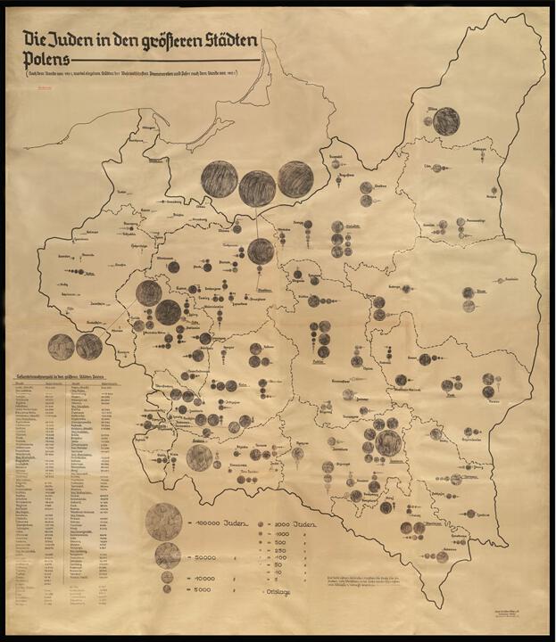
This map was sketched at the Nazi Institute for the Study of Jewish Affairs established by the Nazi regime prewar. After conquering Germany, the Allies found the map in the Gestapo archives. Its size is 132 by 150 centimetres.
At the top of the original map is an inscription in large red letters stating “geheim!” – “top secret!” The map accurately describes the distribution of the Jewish population in Poland according to a census conducted in 1931. The size of the circles symbolizes the size of the Jewish community in each city. The largest circles indicate a population of one hundred thousand people, and the smaller circles indicate respectively fifty thousand people, ten thousand, two thousand, a thousand etcetera. With classic German precision, the creators even indicated the smallest populations, including communities of only five Jews.
This map is one of the many proofs that the annihilation of the Jews was planned in detail and strictly managed by the Nazis, with a clear and stated goal of wiping out the entire Jewish People.